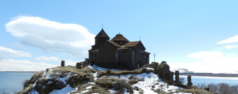
Location, structure and history : Hayravank is located in the north-eastern edge of the Hayravank village, to the left from the Sevan-Gavar road. It is situated on a stony cape in the Lake Sevan area, the church looks like a really unassailable castle (GPS co-ordinates by the list). It can be accessed by turning to the left from the highway cross-roads (there is a sign on the cross-roads). In the annalistic sources Hayravank is mentioned as Hayr Hovhanni, ...
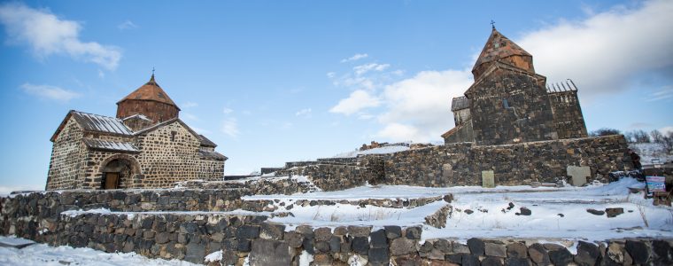
Location, structure and history: Sevanvank monastery is located to the north-east from Sevan town on the Sevan peninsula on the western side of Lake Sevan. It can be accessed by taking the right turn from the Sevan-Dilijan highway along the asphalt road, which leads to Sevan peninsula (the distance from the Sevan-Gavar cross-roads to the isle is 7km and from the isle cross-roads to the monastery 1.3km).
Due to its uniqueness and beauty Sevan peninsula has...
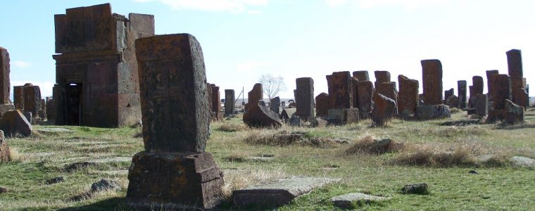
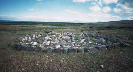
Location, structure and history: The cemetery is situated in the East end of the village of Noratus on a large low lying hill. It is accessible from the village road and is situated 1.6km from the Gavar-Martuni highway.
This well known cemetery consists of two parts: old and new that have actually already been mixed. The old cemetery started from the Western end of the hill where burials were carried out to a systematic plan from the North to the South. T...
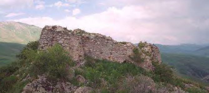
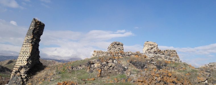
Location, structure and history: The fort is situated between the villages of Martuni and Aygut bout 6km to the north-west of the village of Martuni and 3km to the north-east of the village of Aygut. The fort is situated on the Southern foothills of the Murkhuz mountain range on the right bank of the river Getik, 1km south-west of a location called Aghjaghala. There are ruins of constructions and a church, as well as khachkars preserved here on the top of ...
Location, structure and history: The settlement is situated on the South and West sides of the village of Tsovak standing 50-60m higher than the environs. The site is accessible on foot through the road leading from the village of Tsovak to the mountain plateau or by using the Tsovak- Lchavan road to access the mountainous plateau, as well as taking the old Martuni-Vardenis road.
The citadel is surrounded with inaccessible slopes on three sides and joins ...
Location, structure and history: The site is built on a rocky hill facing Lake Sevan in the North, and is situated at about 1.5km West of the village of Tsovinar, in the Eastern part of the village. It is easily accessible through the village by the old road leading to the village of Artsvanist.
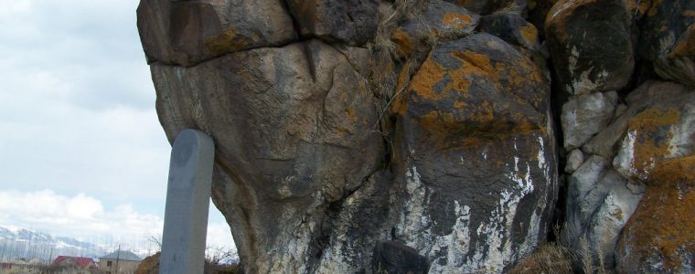
At the south-west part of the fort immediately left of the Tsovinar- Artsvanist road at the frontal part of a rock there is a Cuneiform left by the King Rusah I o...
Location, structure and history: These sites are situated 12km south-east of the town of Gavar, to the left of the Gavar-Martuni highway on the Western side of Lake Sevan in the administrative area of the village of Karmirgyugh 8,5km to the south-east. The fort is situated on a large cape plateau covering an area of about 30ha, surrounded by Lake Sevan on 3 sides. The area is occupied by ruins of a large Medieval village named Qanagegh or Manuchari Dolakne...
Location, structure and history: This monument is situated in the Eastern part of Berdkunq village om the bank of Sevan Lake. The site is accessible through the village road turning left from the Yerevan-Gavar highway. The
Cyclopean fortress stands on a big rock and dominating the surroundings. It is almost inaccessible from all sides except from Berdkunq village in the East. Through its external view and construction the fort is dated sometime around the...
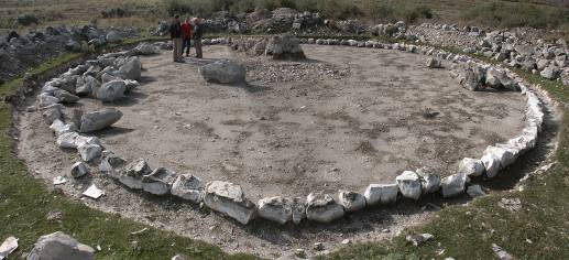
Location, structure and history : Lchashen fortress is situated on high hills in the Southern part of the village of Lchashen. It occupies more than 35ha, and stretches over 15 hills their slopes and gorges. The fortress which is located approximately 50-100m above the surroundings stands high over the neighbourhood. The total length of the external walls of the castle and the settlement are 5000m. The area itself and the surroundings are very stony being ...
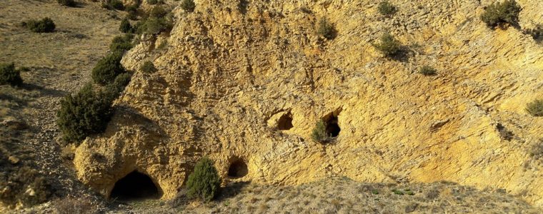
Location and formation The Gili cave shelters are situated 1.5 km to the south-west of the village of Gili to the left side of the Tsovagyugh-Gili road in the immediate neighborhood of the road. The cave shelters are accessible from
the highway, on foot over a small hill and railway line. These are artificial caves dug in the cretaceous mass; the biggest cave is situated in the left part of the complex. The caves served as hiding places or shelter when th...