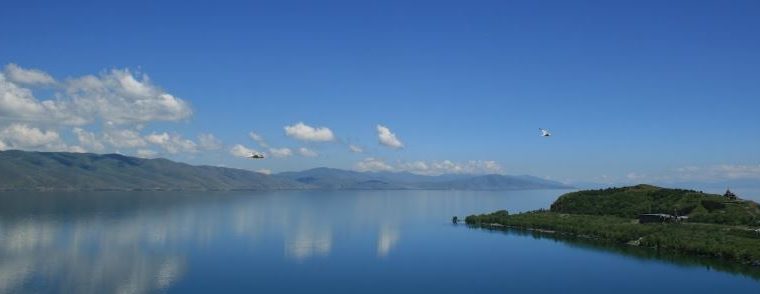
Lake Sevan (Armenian: Սևանա լիճ, Sevana lich) is the largest body of water in Armenia and the Caucasus region. It is one of the largest freshwater high-altitude (alpine) lakes in Eurasia. The lake is situated in Gegharkunik Province, at an altitude of 1,900 m (6,234 ft) above sea level. The total surface area of its basin is about 5,000 km2 (1,900 sq mi), which makes up 1⁄6 of Armenia’s territory. The lake itself is 1,242 km2 (480 sq mi), and the volume is 32.8 km3 (7.9 cu mi). It is fed by 28 rivers and streams. Only 10% of the incoming water is drained by the Hrazdan River, while the remaining 90% evaporates.
The lake provides some 90% of the fish and 80% of the crayfish catch of Armenia. Sevan has significant economic, cultural, and recreational value. Its only island (now a peninsula) is home to a medieval monastery.
Sevan was heavily exploited for irrigation of the Ararat plain and hydroelectric power generation during the Soviet period. Consequently, its water level decreased by around 20 m (66 ft) and its volume reduced by more than 40%. Two tunnels were later built to divert water from highland rivers, which halted its decline and its level began rising. Before human intervention dramatically changed the lake’s ecosystem, the lake was 95 m (312 ft) deep, covered an area of 1,416 km2 (547 sq mi) (5% of Armenia’s entire area), and had a volume of 58.5 km3 (14.0 cu mi). The lake’s surface was at an altitude of 1,916 m (6,286 ft) above sea level.
Etymology
The scholarly consensus is that the word Sevan originated from the Urartian word su(i)n(i)a, usually translated as “lake”. The term is found on an 8th-century BC cuneiform inscription by the Urartian king Rusa I, found in Odzaberd, on the southern shore of the lake. Per folk etymology, Sevan is either a combination of sev (“black”) + Van (i.e., Lake Van) or sev (“black”) and vank’ (“monastery”). Russian and European sources of the 19th and early 20th century sometimes referred to the lake as Sevanga or Sevang. It is the Russified version of the Armenian sev vank’ (“black monastery”) or, possibly, derives from the Armenian phrase սա է վանքը sa ē vank’ə (“this is the monastery”).
Since antiquity up to the Middle Ages, Sevan was mostly known as a sea and referred to in Armenian as the Sea of Gegham (classical Armenian: ծով Գեղամայ, tsov Geghamay).[a] In classical antiquity, the lake was known as Lychnitis (Ancient Greek: Λυχνῖτις). The historic Georgian name of the lake is Gelakuni (გელაქუნი).
Significance
Cultural
Along with Lake Van and Lake Urmia, Sevan is considered one of the three great “seas” of historic Armenia. It is the only one within the boundaries of present-day Republic of Armenia, while the other two are located in Turkey and Iran, respectively. Lake Sevan is considered the “jewel” of Armenia and is “recognized as a national treasure” in the country. The 2001 Law on Lake Sevan defines the lake as “a strategic ecosystem valuable for its environmental, economical, social, scientific, cultural, aesthetic, medical, climatic, recreational, and spiritual value.” Naturalist and traveler Friedrich Parrot, best known for ascending Mount Ararat in 1829 for the first time in history, wrote that.
Economic
It is important for the Armenian economy: being the main source of irrigation water, Sevan provides low-cost electricity, fish, recreation, and tourism.
Origin
Sevan originated during the early Quaternary when a Palaeo-Sevan, ten times larger than the present lake, came into existence by tectonic formation. The current lake was formed some 25 to 30 thousand years ago.
Human intervention
Exploitation and reduction
Background
Sevan was recognized as being a major potential water resource in the 19th century. Its high attitude location relative to the fertile Ararat plain and limited energy resources attracted engineers to explore ways of usage of the lake’s water. In his 1910 book, Armenian engineer Sukias Manasserian proposed to use Sevan’s water for irrigation and hydroelectric power generation. He proposed draining the lake by 50 m (160 ft). Major Sevan would completely dry out, while Minor Sevan would have a surface area of 240 km2 (93 sq mi).
Implementation
Manasserian’s proposal was adopted by the Soviet authorities in the 1930s when, under Joseph Stalin, the country was undergoing rapid industrialization. Works on the project started in 1933. The riverbed of Hrazdan was deepened thorough excavation. A tunnel was bored around 40 metres (130 ft) under the lake’s surface. The tunnel was completed in 1949 and thereafter the Sevan’s level began to drop significantly, at a rate over 1 metre (3 ft) per year. The water was used for irrigation and the Sevan–Hrazdan Cascade of six hydroelectric power stations on Hrazdan River.
Effects
During the second half of the 20th century, the ecological condition of Lake Sevan underwent tangible changes and vast degradation due to reduced water level, increased eutrophication, and detrimental impact of human activity on the biological diversity of the lake. According to Babayan et al. the lake level dropped by 19.88 m (65.2 ft) by 2002, while the volume decreased by 43.8% (from 58.5 to 32.9 km3 [14.0 to 7.9 cu mi]). Due to the water level decrease, the quality of the water deteriorated, natural habitats were destroyed that meant loss of biodiversity. Vardanian wrote that drop of the lake level and the economic development in the basin brought about the change in hydro-chemical regime of the lake. The quality of the water deteriorated, water turbidity increased. The inner circulation of the water constituents as well as the circulation of the biological substances altered.
Reversal and recovery
According to Babayan et al. “by the 1950s it had become evident that the ecological and economic consenquences of extensive exploitation of the water of Lake Sevan were too undesirable to continue in the same way.
Arpa–Sevan tunnel
In 1964 a project began to divert the Arpa River (from a reservoir near Kechut) through a 49 km (30 mi) long tunnel to the lake near Artsvanist.[48][49] The tunnel, called Arpa–Sevan, was completed in 1981. It brings up to 200 million cubic metres (7.1 billion cubic feet) of water to Sevan per year.
It is estimated, that due to climate change by year 2030, the outflow of the Arpa river will decrease by 22%.
Vorotan–Arpa tunnel
Since the water level in the lake did not rise as fast and as much, on 20 April 1981 the Council of Ministers of the Soviet Union made a decision for the construction of the Vorotan–Arpa tunnel. This 21.6 km (13.4 mi) long tunnel was begun from the Spandarian Reservoir on the Vorotan River further south from Kechut. Due to the Nagorno-Karabakh conflict and the 1988 earthquake in northwestern Armenia construction was halted. The tunnel was inaugurated on 26 April 2004. The Vorotan–Arpa tunnel brings an additional 165 million cubic metres (5.8 billion cubic feet) to the lake annually.
Increase in water level
After the construction of the two tunnels the water level began rising significantly since the mid-2000s. In 2007 it was reported that the water level had risen by 2.44 metres (8.0 ft) in the previous six years. It reached 1,900.04 m (6,233.7 ft) in October 2010. The government committee on Sevan forecasts that the level will reach 1,903.5 m (6,245 ft) by 2029.